
Weather Forecasts
(Reviewed on 4th April 2021)
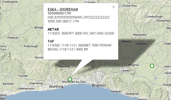
Terminal Aerodrome Forecast (TAF)
Over the years, I have seen many students struggle with the subject of Meteorology. Meteorology is a very large subject and as a student pilot you will only be learning the basics. We concentrate on what is important to aviation. Weather is such an important factor when flying, that we need to take it seriously and know where to get weather information.
There are numerous sources for weather information and as pilots, we need to try and look at more than one type of information. Some types of information are:
- Synoptic charts
- Significant weather charts
- METARs
- TAFs
- VOLMET
- Satellite images
- Infra red images
- Rainfall radar
For this post, I am going to concentrate on TAFs as many students seem to struggle with decoding them. There are many apps and services online that will decode TAFs for you. However you still need to know how to decode them if you want to pass your flight test and your written exams.
Worked Example 1
TAF EINN 220500Z 2206/2306 31007KT 9999 SCT020 BKN030 BECMG 2206/2208 31012KT TEMPO 2214/2221 31015G26KT=
TAF Decode:
- TAF = Terminal Area Forecast. I.e. this is not a weather report. It is a weather forecast
- 220500Z = Forecast was made on the 22nd day (month is not provided) at 0500hrs (UTC)
- 2206/2306 = The Forecast is valid for the time period from 0600hrs on the 22nd day to 0600hrs on the 23rd day
- 31007KT = Wind is coming from 310 degrees (True) and has a speed of 7 knots
- 9999 = Visibility is greater than 10 kilometers
- SCT020 BKN030 = Clouds are Scattered (2 to 4 oktas) with cloud base at 2000 feet and Broken (5 to 7 oktas) with cloud base at 3000 feet
- BECMG 2206/2208 = Becoming (during the period of 0600hrs to 0800hrs on the 22nd day)
- 31012KT = Wind is coming from 310 degrees (True) at a speed of 12 knots
- TEMPO 2214/2221 = Temporarily between the period of 1400hrs and 2100hrs on the 22nd day. (TEMPO means a temporary variation lasting less than 60 minutes or, if recurring, lasting in total less than half the Trend or TAF period.)
- 31015G26KT = Wind coming from 310 degrees (True) at a speed of 15 knots gusting to 26 knots
Worked Example 2
TAF EIDW 110500Z 1106/1206 13010KT 9000 BKN010 BECMG 1106/1108 BKN018 PROB30 TEMPO 1108/1116 17025G40KT 4000 TSRA BKN012CB BECMG 1118/1121 3000 BR NSC=
TAF Decode:
- Twenty four-hour TAF issued at 0500 UTC on the 11th
- Dublin valid from 0600hrs on the 11th to 0600hrs on the 12th
- Wind 130 degrees ten knots
- Nine kilometres visibility
- Broken at 1000 feet
- Becoming from 0600hrs on the 11th to 0800hrs on the 11th
- Broken at 1800 feet
- 30% probability, temporarily between 0800hrs on the 11th to 1600hrs on the 11th
- Wind 170 degrees 25 knots, gusting to 40 knots
- 4000 metres visibility
- Thunderstorm with moderate rain
- Broken cumulonimbus at 1200 feet
- Becoming from 1800hrs on the 11th to 2100hrs on the 11th, 3000 metres visibility, mist, no significant cloud
TAF Decodes
| Code Element | Example | Decode | Notes |
|---|---|---|---|
| Report type | TAF | ‘Terminal Aerodrome Forecast’ | Name for an aerodrome forecast |
| Location | EIDW | "Dublin" | Station four-letter ICAO indicator |
| Date/Time of origin Zulu is equivalent to UTC | 130500Z | ‘For the 13th at 0500hrs Zulu’ | |
| Validity time | 1306/1406 | ‘Valid from 0600hrs on the 13th to, 0600hrs on the 14th | UTC (Greenwich Mean Time) |
| Wind | 31015G25KT | ‘310 degrees, 15 knots, max twenty five knots’ | VRB = Variable; 00000KT = calm. Wind direction is given in degrees true |
| Prevailing visibility or CAVOK* | 8000 | ‘Eight kilometres’ | 9999 = 10 km or more; 0000 = less than 50 metres |
| Significant weather | -SHRA | ‘Light rain showers’ | NSW = No significant weather |
| Cloud | FEW005 SCT010 SCT018CB BKN025 | ‘Few at five hundred feet, scattered at one thousand feet, scattered cumulonimbus at one thousand eight hundred feet. Broken at two thousand five hundred feet’ | FEW = 1-2 oktas; SCT = 3-4 oktas; BKN = 5-7 oktas; OVC = 8 oktas; ‘VV///’ = state of sky obscured (cloud base not discernible); figures in lieu of ‘///’ give forecast vertical visibility in hundreds of feet. NSC = no significant cloud (none below 5,000 feet and no TCU or CB) TCU and CB will be the only cloud types specified. Cloud heights are given in feet above airfield height. |
| Significant changes Probability Time Change indicator Met. groups | PROB30 1314/1316 BECMG 1314/1316 FM131400 TSRA BKN010CB | ‘30% probability’ ‘from 1400hrs on the 13th to 1600hrs on the 13th,’ or ‘becoming from 1400hrs on the 13th to 1600hrs on the 13th’ or ‘from 1400hrs on the 13th’ followed by ‘Thunderstorm with rain, broken cumulonimbus at 1000 feet’ | Only 30% or 40% probability will be used. Indicates beginning and end time of forecast period in UTC. Also TEMPO = temporarily may be used. Met. group follows indicating a change in some or all of the elements forecast in the first part of the TAF. |
* CAVOK will replace visibility and cloud groups.
Other abbreviations that you may come across are listed below:
- + = Heavy (well developed in the case of +FC and +PO)
- – = Light
- no qualifier = Moderate
- BC = Patches
- BECMG = Becoming
- BL = Blowing
- BR = Mist
- CAVOK = Visibility greater or equal to 10 km, no cumulonimbus or towering cumulus, no cloud below5,000 ft or highest minimum sector altitude (MSA) (whichever is the greater) and no weather significant to aviation.
- DR = Drifting
- DS = Duststorm
- DU = Dust
- DZ = Drizzle
- FC = Funnel cloud
- FG = Fog
- FU = Smoke
- FZ = Freezing
- GR = Hail (>5 mm)
- GS = Small hail or snow pellets
- HZ = Haze
- IC = Ice crystals
- MI = Shallow
- PL = Ice pellets
- PO = Dust devils
- PR = Banks
- RA = Rain
- SA = Sand
- SH = Showers
- SG = Snow grains
- SN = Snow
- SQ = Squalls
- SS = Sandstorm
- TS = Thunderstorm
- VA = Volcanic ash
- VC = In vicinity
Did you enjoy this post? Why not leave a comment below and continue the conversation, or subscribe to my feed and get articles like this delivered automatically to your feed reader.


Comments
No comments yet.
Sorry, the comment form is closed at this time.